
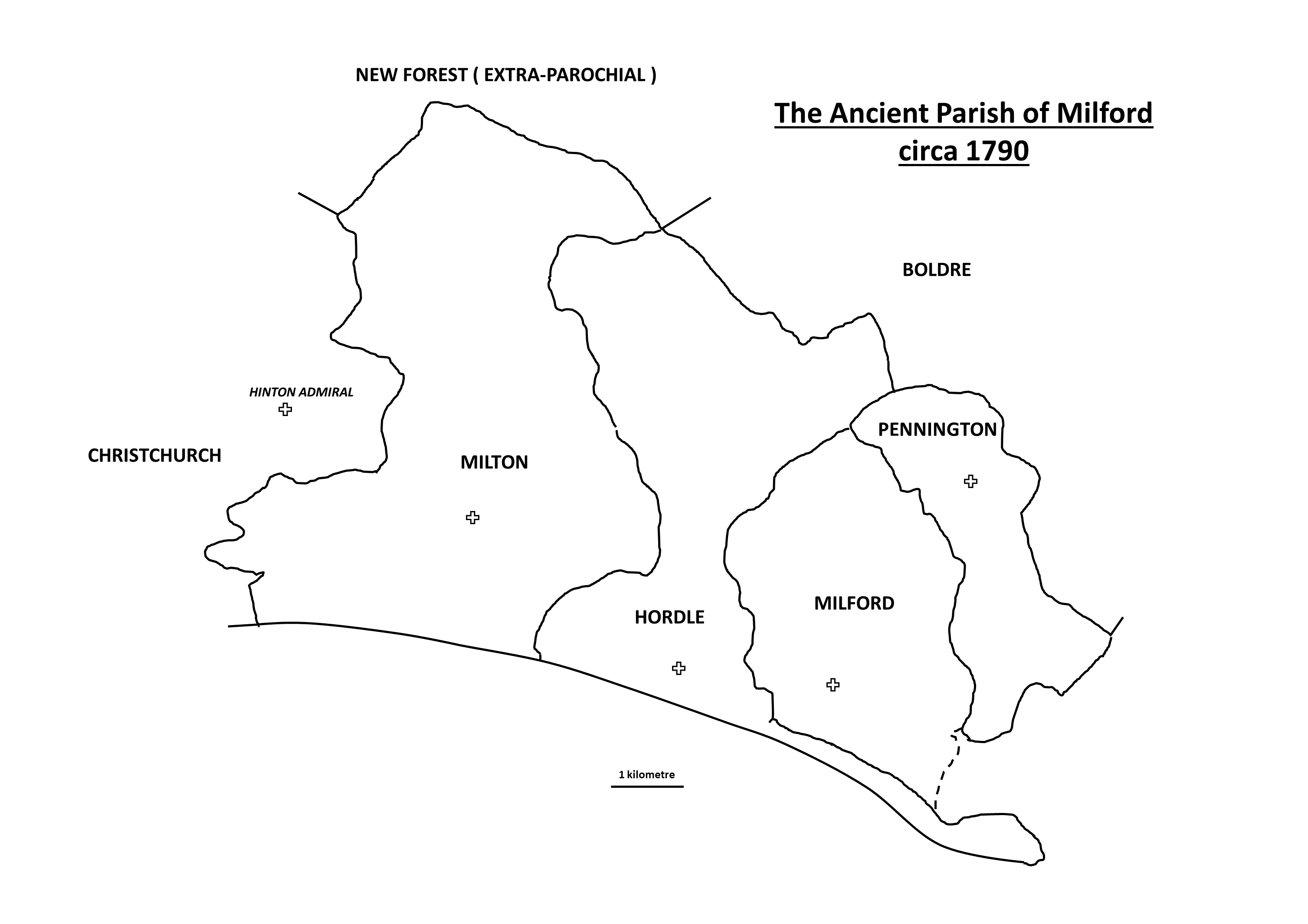
The Ancient Parish of Milford may be re-created using Phillimore’s pre-1832 parochial boundaries.
It extended westwards to include Highcliffe and Walkford (but not as far west as Hinton), northwards to include Brownhill Inclosure, Wootton Coppice Inclosure, Mead End and Bowling Green, and as far eastwards as Priestlands, Lower Pennington and Pennington Marshes. The sea formed the southern boundary and part of the eastern boundary. Over time with coastal erosion and storms breaching Hurst Spit these boundaries were reduced.
It is estimated that in 1720 the Ancient Parish was some 16,700 acres and in the last three hundred years the parish has lost some 2,200 acres of land to the sea. Today the civil parish is 2,900 acres without New Milton, Hordle or Pennington.
Links
https://www.british-history.ac.uk/vch/hants/vol5/pp115-124
References
Hampshire Record Series, Volume XVIII, The Christchurch Priory Cartulary, Edited by Katharine A. Hanna. Published by Hampshire County Council, Winchester 2007.
The Phillimore Atlas and Index of Parish Registers. 3rd Edition, Edited by Cecil R. Humphrey-Smith, Phillimore, West Sussex, 2003.
Records
If you would like to research Milford’s history, search the archive.
If you have some documents, images or artefacts which tell some of Milford’s history and would like to add them to the archive then please get involved.


No Comments
Add a comment about this page